Orientation-selective building detection in aerial images
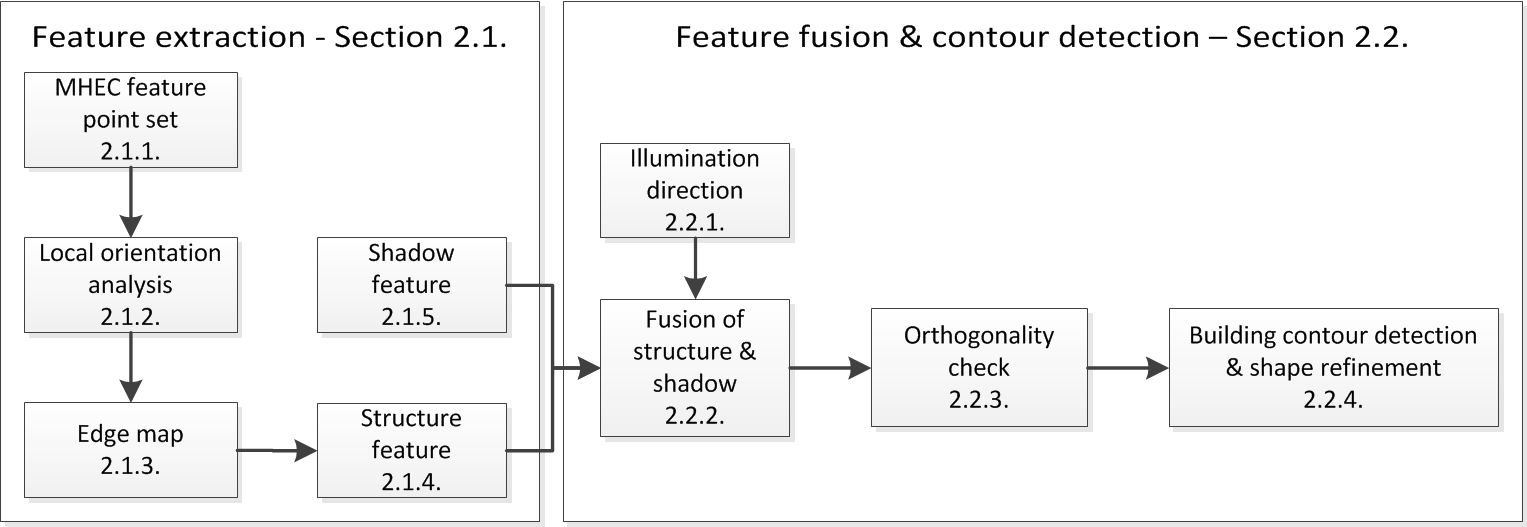
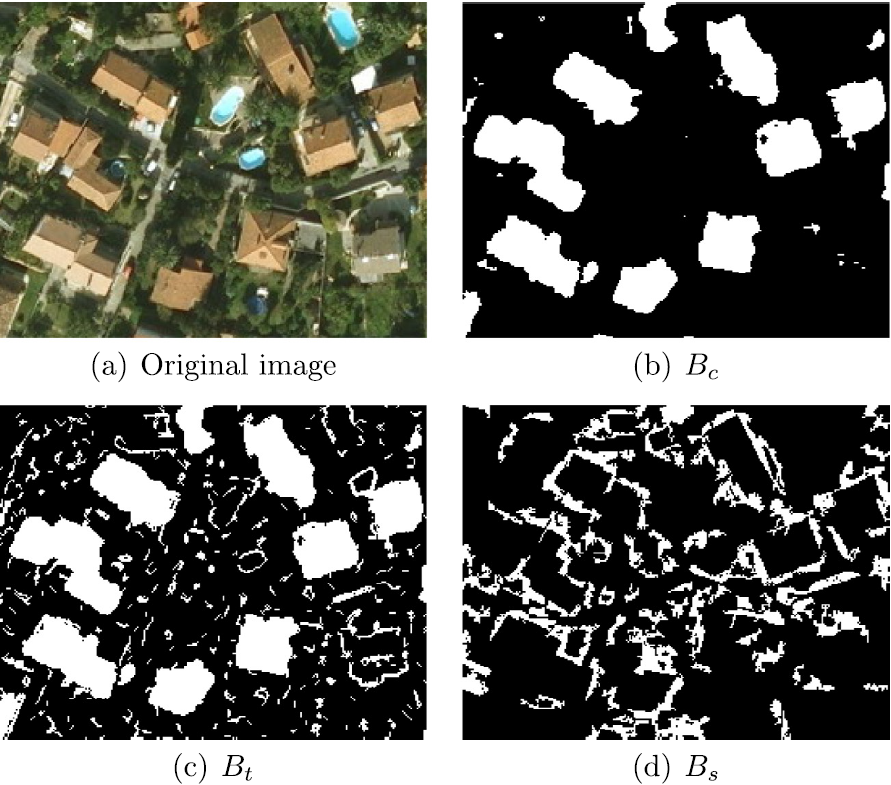
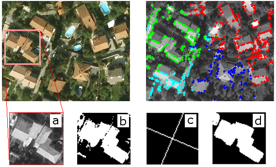
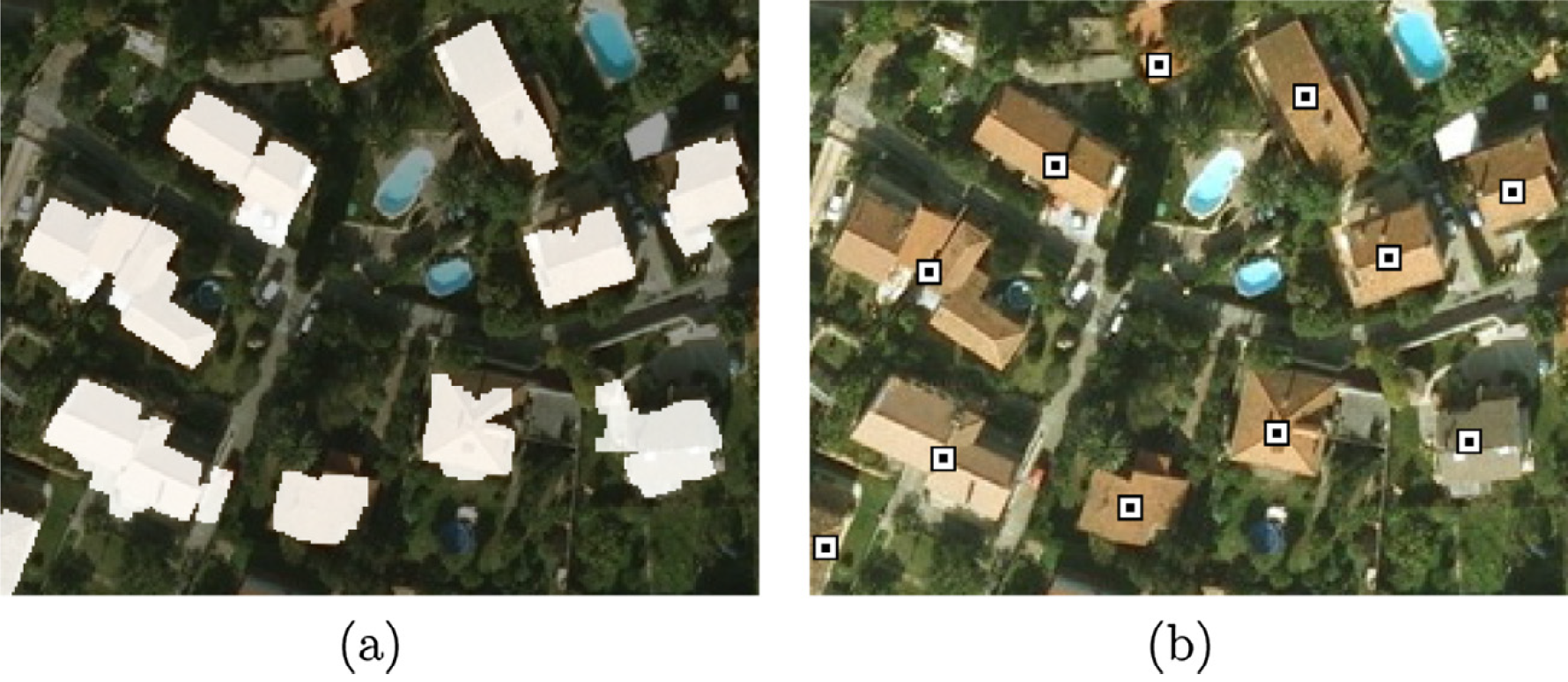
A novel aerial building detection method was introduced based on region orientation as a new feature, which is used in various steps throughout the presented framework [Fig. 1]. As building objects are expected to be connected with each other on a regional level, exploiting the main orientation obtained from the local gradient analysis provides further information for detection purposes. The orientation information is applied for an improved edge map design [Fig. 2(c)], which is integrated with classical features like color [Fig. 2(b)] and shadow [Fig. 2(d)]. Moreover, an orthogonality check is introduced for finding building candidates, and their final shapes defined by the Chan-Vese active contour algorithm [Fig. 3(b)] are refined based on the orientation information [Fig. 3(c)], resulting in smooth and accurate building outlines [Fig. 3(d)]. The proposed framework is evaluated on multiple data sets [sample result in Fig. 4], including aerial and high resolution optical satellite images, and compared to six state-of-the-art methods in both object and pixel level evaluation, proving the algorithm's efficiency.
Further details:
A. Manno-Kovacs and T. Sziranyi,"Orientation-selective building detection in aerial images", ISPRS Journal of Photogrammetry and Remote Sensing, vol. 108, pp. 94-112, 2015, IF:4.188 
![]()

Email: andrea.manno-kovacs AT sztaki.mta.hu