Improved Harris feature point set for orientation sensitive urban area detection in aerial images
As manual administration
is time consuming and unfeasible, researchers have to focus on
automated processing techniques, which can handle various image
characteristics and huge amount of data.
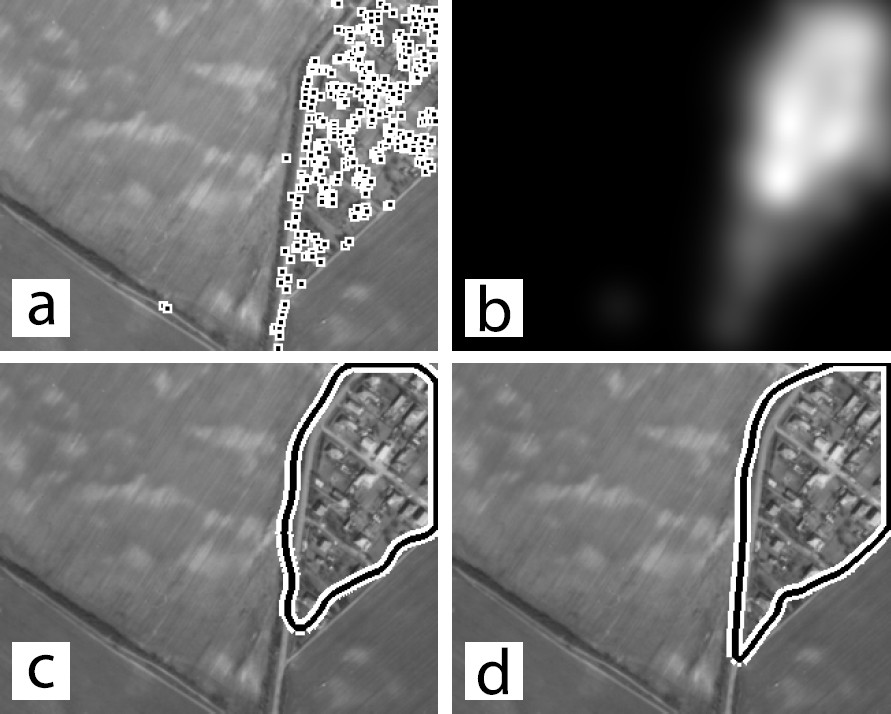
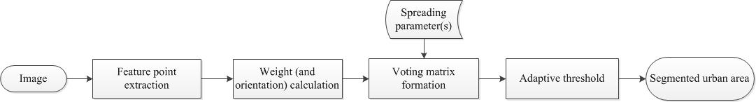
The applied method
extracts feature points in the first step [Fig. (a)], which is followed by the
construction of a voting map to represent urban areas [Fig. (b)]. Finally,
an adaptive decision-making is performed to find urban areas [Figs. (c) and (d)].
We present methodological contributions in two key
issues to the algorithm: (1) An automatically extracted, Harris
based feature point set is introduced for the first step, which is
able to represent urban areas more precisely [Fig. (a)]. (2) An improved,
orientation-sensitive voting technique is proposed, exploiting the
orientation information calculated in the local neighborhood of
points. Evaluation results show that the proposed contributions
increase the detection accuracy of urban areas. Fig. (c) shows detection without orientation information, Fig. (d) shows the introduced, orientation-sensitive detection.
Methodology:
Further details:
A. Kovacs and T. Sziranyi, "Improved Harris Feature Point Set for Orientation Sensitive Urban Area Detection in Aerial Images", IEEE Geoscience and Remote Sensing Letters, vol. 10, no. 4, pp. 796-800, 2013, IF:1.809 


Email: andrea.manno-kovacs AT sztaki.mta.hu