GeoComp benchmarks
Research Group on Geo-Information Computing (GeoComp)
SZTAKI Change3D dataset (SZTAKI-Change3D)
The SZTAKI Change3D dataset (SZTAKI-Change3D) has been created by Balázs Nagy, Lóránt Kovács and Csaba Benedek for the purpose of evaluating 3D change detection methods on a slightly unregistered dataset.
Dataset descrption
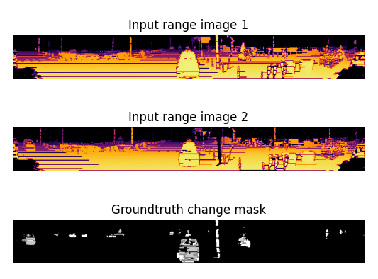
The measurements were recorded in the downtown of Budapest, Hungary on two different days by driving a car with a Velodyne HDL-64 rotating multi-beam Lidar attached to its roof. The database contains ~2000 png images with 1024x384 size. These are generated by stacking vertically the two range images and their correspondig ground truth change mask.
Example code
In the dataset one will find a python scrip, which loads the elements of the database and splits and normalizes these trio images to separate 1024x128 sized images: range image1, range image2 and groundtruth change mask. The split images are displayed in separate subfigures. Running the code requires cv2 and matplotlib pyhton packages.
Database download
Download public samples from the SZTAKI-Change3D training dataset (410MB).
Database samples
 |
 |
 |
 |
Change detection examples
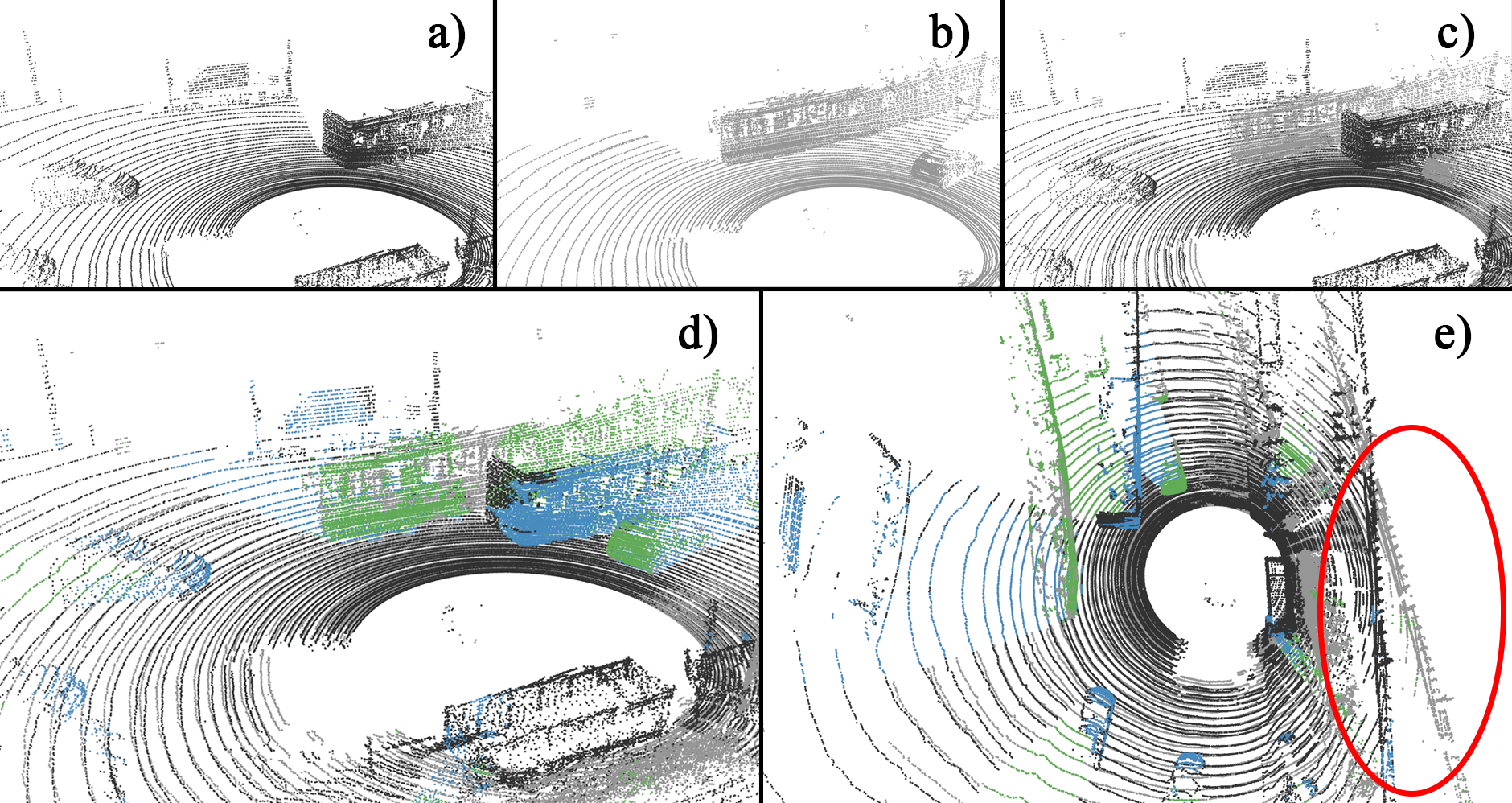
Changes detected by ChangeGAN for a coarsely registered point cloud pair.(a) and (b) show the two input pointclouds,
(c) displays the coarsely registered input point clouds in a common coordinate system.
(d),(e) present the changedetection results: blue and green colored points represent the objects marked as changes in the first and second point cloud,respectively.
The red ellipse shows the global alignment difference between the two coarsely registered pointclouds.

ChangeGAN result on consecutive frames of sequence 2011_09_26_drive_0014 from the KITTI [1] dataset:
 |
 |
[1]: A. Geiger, P. Lenz, C. Stiller, and R. Urtasun, “Vision meets robotics: The KITTI dataset, ”International Journal of Robotics Research,vol. 32, no. 11, pp. 1231 – 1237, Sept. 2013.

Links
Geo-Information Computing @ Machine Perception Lab.
GeoComp Demos:
Contact
GeoComp Group leader: Dr. Csaba Benedek benedek.csaba@sztaki.hu
i4D project manager: Dr. Zsolt Jankó janko.zsolt@sztaki.hu
Head of MPLab: Prof. Tamás Szirányi
MPLab administration: Anikó Vágvölgyi
Address:
SZTAKIKende utca 13-17
H-1111 Budapest, Hungary Tel: +36 1 279 6194
Fax: +36 1 279 6292