GeoComp benchmarks
Research Group on Geo-Information Computing (GeoComp)
SZTAKI-INRIA Building Detection Benchmark
co-authors: Csaba Benedek (SZTAKI), Xavier Descombes (INRIA Sophia-Antipolis, France) and Josiane Zerubia (INRIA Sophia-Antipolis, France)
Description
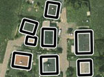
This Benchmark set contains the rectangular footprints of 665 buildings in 9 aerial or satellite images taken from Budapest, Szada (both in Hungary), Manchester (UK), Bodensee (Germany), Normandy and Cot d'Azur (both in France). This Ground Truth data was used for evaluation in [1].
Dataset details
Each folder contains a raw image, a Ground Truth (GT) text file and an image containing overprints of GT rectangles (later one only for visual checking the GT).
The GT textfile can be interpreted in the following way:
n
xpos1 ypos1 sideL1 sidel1 angle1
xpos2 ypos2 sideL2 sidel2 angle2
...
xposn yposn sideLn sideln anglen
where n is the number of GT rectangles, xpos and ypos are the coordinates of the rectangle centers, sideL and sidel are the side length values and angle is the orientation difference from the vertical axis (See Fig. 1 in [1]*).
Sample images
 |
|||
Terms of usage:
The benchmark set is free for scientific use.
- Please acknowledge the use of the benchmark by referring to our PAMI publication [1]*, and optionally some of the following ones [2], [3], [4] or [5].
- Please notify us if a publication using the benchmark set appears.
Download:
References
[1] Cs. Benedek, X. Descombes and J. Zerubia: ”Building Development Monitoring in Multitemporal Remotely Sensed Image Pairs with Stochastic Birth-Death Dynamics”, IEEE Trans. on Pattern Analysis and Machine Intelligence vol. 34, no. 1, pp. 33-50, 2012
[2] Cs. Benedek, X. Descombes and J. Zerubia: ”Building Detection in a Single Remotely Sensed Image with a Point Process of Rectangles,” International Conference on Pattern Recognition (ICPR), pp. 1417-1420, Istanbul, Turkey, August 23-26, 2010
[3] Cs. Benedek: ”Efficient Building Change Detection in Sparsely Populated Areas Using Coupled Marked Point Processes,” IEEE International Geoscience and Remote Sensing Symposium (IGARSS), pp. 3214-3217, Honolulu, Hawaii, USA, July 25-30, 2010 received travel grant award
[4] Cs. Benedek, X. Descombes and J. Zerubia: ”Building Extraction and Change Detection in Multitemporal Remotely Sensed Images with Multiple Birth and Death Dynamics,” IEEE Workshop on Applications of Computer Vision (WACV), Snowbird, Utah, USA, December 7-8, 2009
[5] Cs. Benedek, X. Descombes and J. Zerubia, ”Building extraction and change detection in multitemporal aerial and satellite images in a joint stochastic approach”, Research Report 7143, INRIA Sophia Antipolis, France, December 2009

Links
Geo-Information Computing @ Machine Perception Lab.
GeoComp Demos:
Contact
GeoComp Group leader: Prof. Csaba Benedek benedek.csaba@sztaki.hu
i4D project manager: Dr. Zsolt Jankó janko.zsolt@sztaki.hu
Head of MPLab: Prof. Tamás Szirányi
MPLab administration: Anikó Vágvölgyi
Address:
SZTAKIKende utca 13-17
H-1111 Budapest, Hungary Tel: +36 1 279 6097