GeoComp demos
Research Group on Geo-Information Computing (GeoComp)
Texturing a Lidar based mesh with satellite photos
Lidar data is highly appropriate for generating an accurate 3D mesh model of the city, up to the available resolution. For texturing the mesh, use of additional optical image sources is necessary. Since both the Lidar point clouds and the Pleiades satellite images are geo-referred, it is indeed possible to texture the 3D models with the obtained satellite images. This process makes possible an up-to-date 3D visualization of the data, so that the preliminary prepared city model is automatically shaded by the actual satellite views.
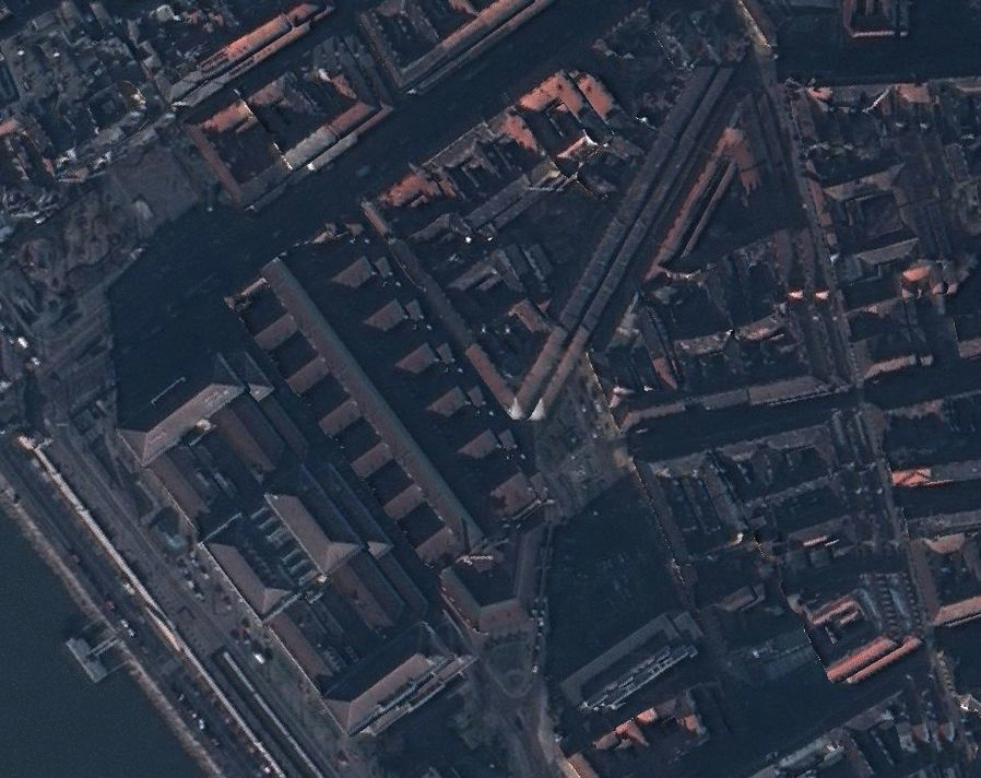
Figure. Textured mesh model of the Corvinus University Budapest, from various viewpoints
Links
Geo-Information Computing @ Machine Perception Lab.
GeoComp Demos:
Contact
GeoComp Group leader: Dr. Csaba Benedek benedek.csaba@sztaki.hu
i4D project manager: Dr. Zsolt Jankó janko.zsolt@sztaki.hu
Head of MPLab: Prof. Tamás Szirányi
MPLab administration: Anikó Vágvölgyi
Address:
SZTAKIKende utca 13-17
H-1111 Budapest, Hungary Tel: +36 1 279 6194
Fax: +36 1 279 6292