Demos on virtual city reconstruction

Building facade reconstruction from Velodyne point cloud streams: based on our intelligent mobile mapping system, we create geometrically reconstructed and textured 3D scene models, visualise various building facades and landmarks

Virtual city reconstruction based on aerial Lidar measurement. Test data provided by Airbus Defense and Space Hungary Ltd.

Texturing an airborne Lidar based mesh with Pleiades satellite photos: an automatic texturing approach has been proposed utiliting the geo-referred data

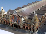
Dynamic virtual city modeling: complete 3D reconstruction flow of the Great Market Hall, Budapest, and displaying a dynamic scenario with multiple pedestrians in front of the building

Mixed reality: pedestrian models from the 4D studio walking in large Velodyne point clouds recorded from landmarks of Budapest, Hungary: Klotild Palace, Budapest University of Technology and Economics and Kalvin square.

Remote sensing: airborne Lidar data segmentation and automatic traffic monitoring: we automatically detect parking and moving vehicles in aerial LIDAR point clouds, and identify groups of corresponding vehicles, such as cars in a parking lot, or a vehicle queue waiting in front of a traffic light.


Links

Geo-Information Computing @ Machine Perception Lab.

GeoComp Research Group

Machine Perception Laboratory

SZTAKI main page

GeoComp Demos:

Demo page

Publications

Contact

GeoComp Group leader: Dr. Csaba Benedek benedek.csaba@sztaki.hu

i4D project manager: Dr. Zsolt Jankó janko.zsolt@sztaki.hu

Head of MPLab: Prof. Tamás Szirányi

MPLab administration: Anikó Vágvölgyi

Address:

SZTAKI
Kende utca 13-17
H-1111 Budapest, Hungary
Tel: +36 1 279 6194
Fax: +36 1 279 6292
Flag Counter