i4D - system description
Project of MTA SZTAKI
Technical description of the i4D system
The two main components of the i4D system are:
- the 3D Space Scan System & 3D virtual space generation software module
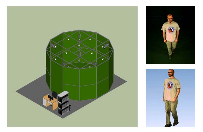
- Dynamic Object Capturing Studio - SZTAKI 4D Studio
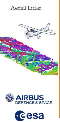
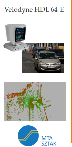
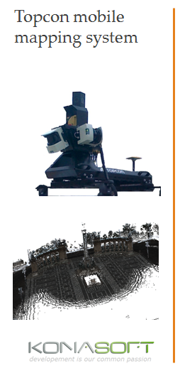
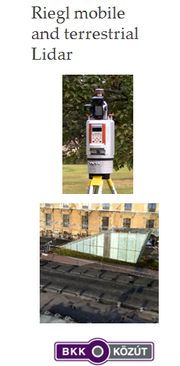
The 3D virtual space generation module is able to handle a large variety of 3D mesh, 3D voxel or point cloud based data formats. In particularly, we deal with various Lidar data types as follows (press on the image parts to see demos):
The SZTAKI 4D Studio has an own webpage, a demonstration video of the 4D moving person reconstruction workflow is in the following (press image):
For an earlier technical sketch if the i4D system, you can download our ICVS 2013 poster [1] (outdated - but the main concept is already available).
Reference
[1] Cs. Benedek, Z. Jankó, Cs. Horváth, D. Molnár, D. Chetverikov and T. Szirányi: ”An Integrated 4D Vision and Visualisation System,” International Conference on Computer Vision Systems, St. Petersburg, Russia, vol. 7963 of Lecture Notes in Computers Science, pp. 21-30, Springer, 2013 ![]()
Links
Geo-Information Computing @ Machine Perception Lab.
GeoComp Demos:
Contact
GeoComp Group leader: Dr. Csaba Benedek benedek.csaba@sztaki.hu
i4D project manager: Dr. Zsolt Jankó janko.zsolt@sztaki.hu
Head of MPLab: Prof. Tamás Szirányi
MPLab administration: Anikó Vágvölgyi
Address:
SZTAKIKende utca 13-17
H-1111 Budapest, Hungary Tel: +36 1 279 6194
Fax: +36 1 279 6292